Mar 7 2017
The US National Oceanic and Atmospheric Administration (NOAA) has received the first images from its satellite-mounted cutting-edge lightning-strike sensor, a ‘quantum leap’ in severe-weather forecasting.
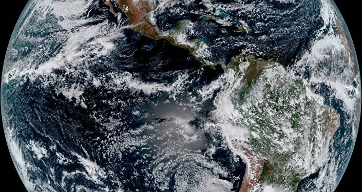
 New Weather Satellite Sends Back Breathtaking Pictures of Earth (Credit: SPUTNIK/ GOES-16)
About 3 billion lightning strikes occur annually, about 100 every second. While reliable global statistics are not available, the 2008 International Lightning Detection Conference estimated that some 264,000 people are struck by lightning every year, with 24,000 of those dying from their injuries.
First Images from GOES-16 Lightning Mapper
To help protect mankind from nature's wrath, NASA launched NOAA's Geostationary Operational Environmental Satellite 16 (GOES-16) in November 2016. GOES-16 is an advanced orbital device equipped to monitor weather on both Earth and outer space.
One of GOES-16's many high-tech instruments is a Geostationary Lightning Mapper (GLM), which tracks lightning strikes across the Western Hemisphere. According to Tim Gasparrini, a Lockheed Martin senior engineer who led the construction of GOES-16, the satellite will significantly improve severe weather forecasting. The GLM will "revolutionize severe storm forecasting," according to Gasparrini. It';s "a quantum leap in forecasting severe weather such as tornadoes."
The GLM takes 500 images a second, of both the lightning that strikes the surface and bolts cross between clouds. Often, lightning will strike a cloud first and then the ground 5-10 minutes later, something that forecasters have been unable to monitor in the past. If the GLM detects an increase in the intensity of the lightning activity, it can alert NOAA that the storm is escalating.
"We will be able to warn sooner than if we only had radar," said NOAA scientist Steven Goodman. "This adds information the forecaster can really use." In a press release, NOAA claimed that the GLM has "produced more lightning data in its first weeks than all previous lightning data from space combined."
Older instruments are limited in their ability to monitor weather over the ocean. The GLM has no such limitation, and can provide potentially life-saving information for aviators and mariners as well.
GOES-16 will work alongside old-fashioned radar and other satellites to help meteorologists anticipate dangerous weather phenomena such as flash floods, brush fires and tornados. This is good news for Americans, including the people of New Orleans, who were struck with a massive tornado in February that injured 33 and caused around $3 million in damages.
Californians, who in January were hit with the state's worst rainstorm in a decade, may also be pleased to hear of improved severe weather detection. Heavy rainfall caused mudslides and flooding in parts of the state, and was the root cause behind the Oroville Dam crisis, after warnings forced 188,000 people to evacuate for several days.
In late February, GOES-16 sent back its first images of the Sun using a Solar Ultraviolet Imager, providing previously-unknown information on solar flares and corona activity.