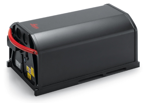
Woolpert has announced that its aircraft fleet has been expanded to fulfill the growing demand for aerial data.The company has expanded its LiDAR equipment range with two airborne Leica ALS70-HP LiDAR scanners, designed specifically for effective mapping of different terrains from high altitudes.
 Leica ALS70-HP
The Leica ALS70 airborne laser scanner provides a pulse rate of 500 kHz, thereby decreasing the on-line flight time by 60%. Featuring advanced multiple-output scanning system, the new ALS70-HP scanners enable data acquisition for its projects in half the time and twice the speed.
Ideally suited for high-density point collection, the Leica ALS70 laser scanners can be used for urban, corridor, general-purpose and flood plain airborne mapping. The three models of the ALS70 laser scanner include the Leica ALS70-HP, the Leica ALS70-CM and the Leica ALS70-HA.
Woolpert, in addition to the new Leica ALS70-HP LiDAR scanners, owns a Leica RC30 aerial camera, a Leica RCD 105 digital camera, Optech Gemini ALTM LiDAR sensors, a Wehrli 3-OC digital oblique sensor, a Leica ADS 80 SH81 and ADS 80 SH82 digital sensor.
The Senior Vice President and the Director of Woolpert’s geospatial services, Jeff Lovin explained that the company handles multiple federal and state-wide mapping programs which increasingly demand high-quality data and enhanced geospatial service, fulfilled by the new LiDAR scanners.
Woolpert is an infrastructure management, geospatial data management and design consulting company catering to clients in both private and public sectors. Headquartered in Dayton, OH, the company has 22 offices in the United States.