Aug 18 2010
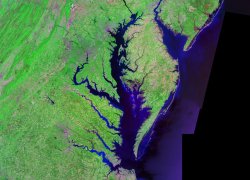
The USDA Forest Service ecologist Megan Lang and the Agricultural Research Service (ARS) soil scientist Greg McCarty mapped wetlands of Chesapeake Bay by integrating LiDAR (light detection and ranging) an airborne laser sensor with a modified "synthetic aperture radar" (SAR) satellite sensor.

The Wetlands are necessary for water bodies like the Chesapeake Bay. But the forested wetlands are sporadically sighted by airborne photography due to the thick foliage hence are not precisely mapped.
The complete information from the two remote sensors provides information on the mode of the flow of filtered and unfiltered water into the Bay. The map furnishes information on the drainage ditches, wetlands, disrupted ponds and streams and also the evolution in the wetlands by ditches, farming, weather and other constructions. These maps can foretell the effect of weather changes and floods.
The researchers utilize upgraded models and software to process data from the remote sensors. With advancements in the recent technologies and with the pervasive utilization of LiDAR, a good deal of information can be compiled regarding the sanitization of the Chesapeake Bay and its preservation. A research paper has been published in the international journal of the Society of Wetland Scientists, Wetland, based on this research.